
Portfolio
Fuaad Khan
GIS Supervisor,GIS Developer,Inland Empire, CA
I build enterprise GIS infrastructure, data pipelines, and the web mapping applications that run on them. Six-plus years in public-sector GIS, from sole GIS staff to supervisor.
Career
The Journey.
From a geography degree to building a city’s enterprise GIS from zero.
Education,2018 – 2020
Where spatial thinking started.
B.A. Geography, minor in GIS & TechnologiesUCLA · Los Angeles, CA
- Geography major with a minor in Geographic Information Systems and Technologies.
- Foundation in cartography, spatial analysis, and geographic problem framing.
- Arrived with a year of ETL and data engineering at UC Riverside already behind me.
GIS / Data Analysis,Oct 2020 – Jul 2021
Maps that ran on data pipelines.
Project Coordinator / GIS Data AnalystCity Net SoCal · Anaheim, CA
- Maintained HMIS data to HUD standards and wrote SQL for shelter and case reports.
- Built daily Power BI dashboards for City of Anaheim staff and Anaheim PD.
- Produced ArcGIS map products for the Orange County Point-in-Time count.
- Automated the reporting workflows behind those maps with Python.
Enterprise GIS,Jul 2021 – present
Built the city’s enterprise GIS from zero.
GIS Coordinator to GIS SupervisorCity of San Jacinto · San Jacinto, CA
- Sole GIS staff: stood up test and production ArcGIS Enterprise from the ground up.
- Integrated GIS with Tyler EPL permitting and OpenGov EAM asset management.
- Led a YOLOv8 computer-vision pipeline that geolocates potholes and traffic assets.
- Promoted to Supervisor in 2025: hiring, leading staff, directing GIS strategy citywide.
My Applications
Things I’ve built.
Three web mapping applications, designed and built end to end for the City of San Jacinto and the people who live there.
Map My City
Every parcel, one search.
In production · internal
Every parcel in San Jacinto. All 18,459, one search away.
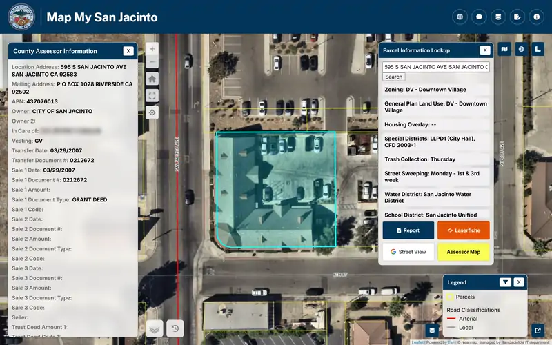
Search any address or APN. Zoning, services, hazards and assessor records in one click.
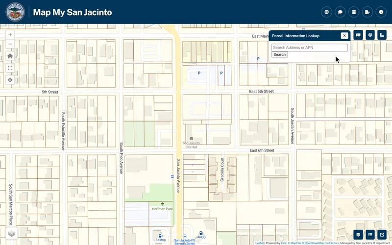
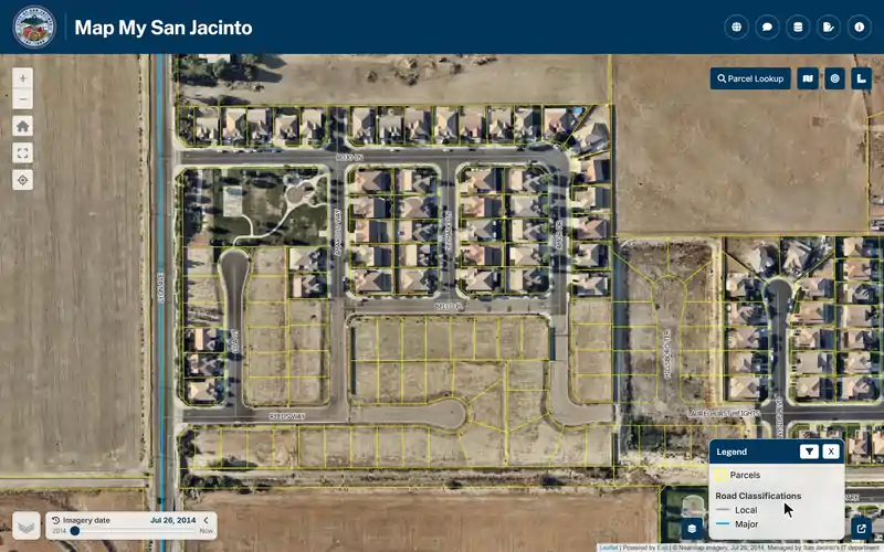
Zoning, land use and hazard layers, plus twelve years of aerial imagery on one slider.
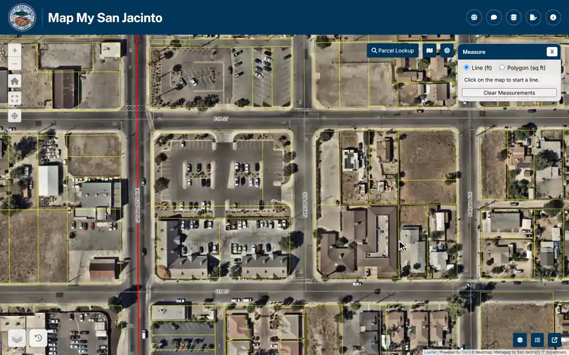
Measure distance and area right on the map.
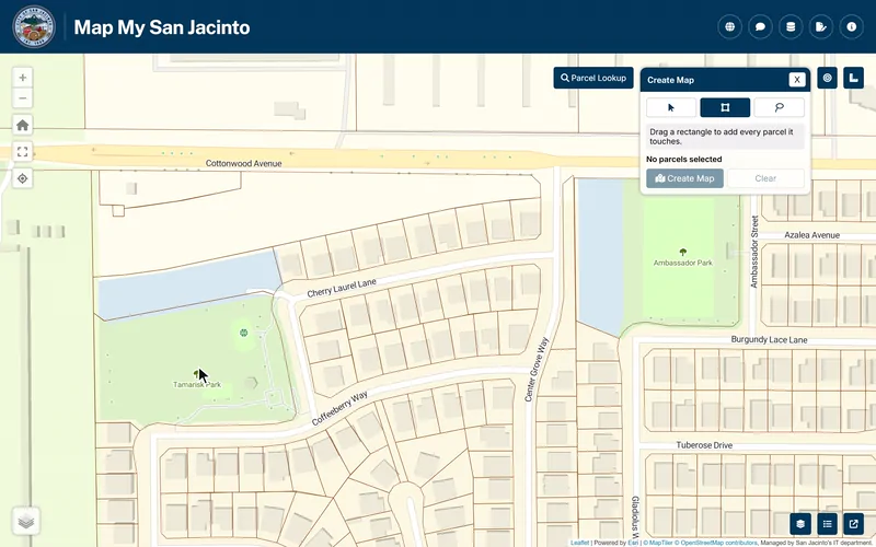
Pick parcels, style them, and print a planning exhibit.
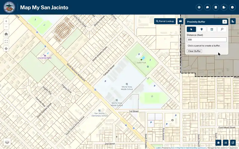
Draw a radius, find every neighbor, print hearing-notice labels.
Map My City at a glance.
Residents and staff need fast, self-serve answers about any parcel: zoning, city services, hazards, and assessor records in one place.
- 18,459parcels
- ~22parallel queries per click
- 54imagery dates, 2014–2026
- Built for
- Residents, planners, and every city staff member.
- Deployed as
- Map My San Jacinto · City of San Jacinto
- Built with
- JavaScript
- Leaflet
- Esri Leaflet
- Turf.js
- MapTiler
- esbuild
Green Check
Can a cannabis business go here?
Pilot · internal preview
Can a cannabis business go here? Ask the map.
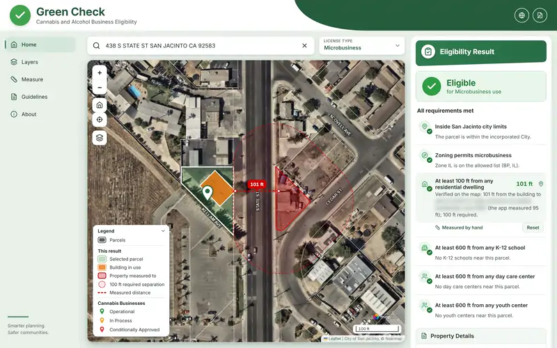
Pick a license type, search an address, get a verdict in about two seconds.
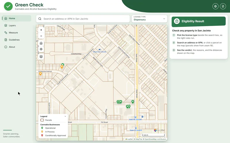
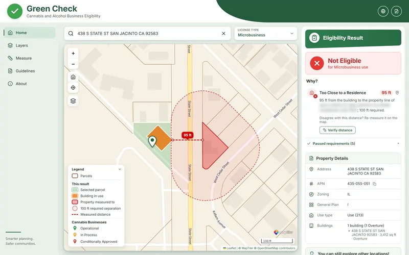
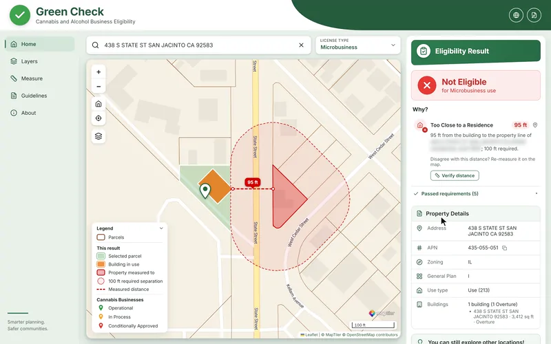
Every rule checked against schools, day cares, youth centers and homes, with the distance drawn on the map.
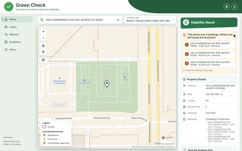
Several buildings on one parcel? Choose the one that will house the business.
Disagree with a distance? Measure it yourself, and the verdict updates.
Green Check at a glance.
Checking whether a cannabis business can open at an address means cross-referencing zoning and buffer rules by hand. Green Check does it in one search.
- ~2 sfrom address to verdict
- 20,211building footprints
- 226automated tests
- Built for
- City planners, code enforcement, and prospective cannabis and alcohol license applicants.
- Built with
- React
- Vite
- Leaflet
- Esri Leaflet
- Turf.js
- MapTiler
- Overture building footprints
Results do not constitute a zoning determination.
Yard Plan
Sketch a front yard without CAD.
In development
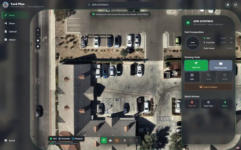
A front yard, drawn to scale on high resolution aerial imagery.
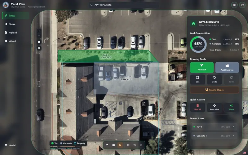
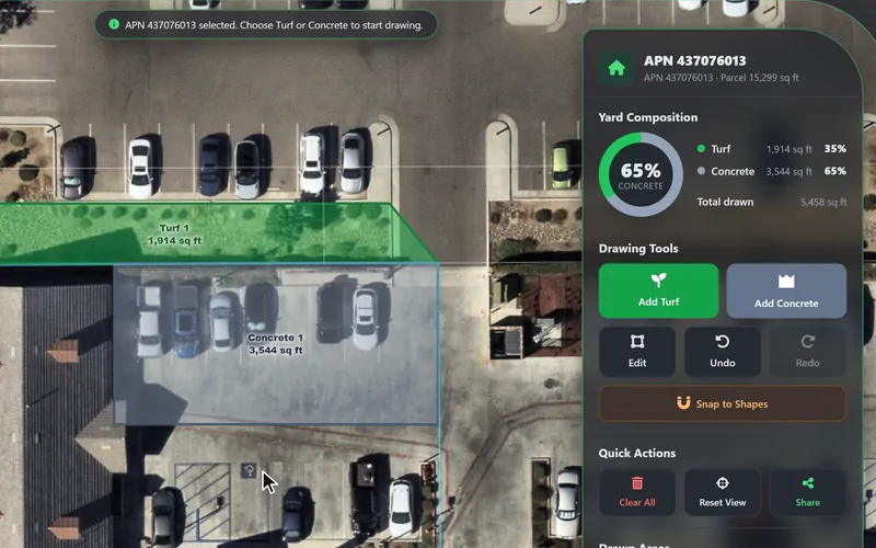
Trace turf and concrete. Corners snap to each other.
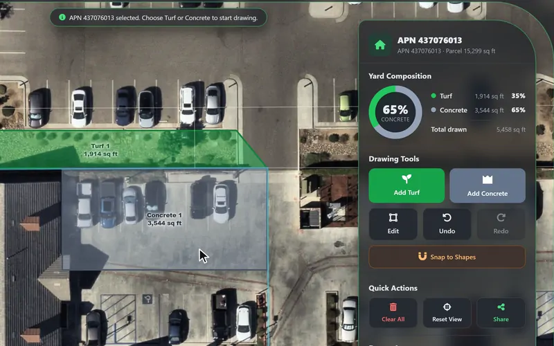
Square footage and concrete share update as you draw.
Download a PDF, or send a link that carries the whole plan.
Yard Plan at a glance.
Empowers homeowners to show the Planning Department how much of a front yard will be turf versus hardscape, so they can stay up to code without learning CAD.
- 13JavaScript modules
- 0frameworks
- ~1,200characters to link a 10-shape plan
- Built for
- Residents planning a front yard, and the planning staff who review it.
- Built with
- JavaScript
- Leaflet
- Leaflet Draw
- Esri Leaflet
- Turf.js
- jsPDF
- Nearmap imagery